iGeekphone October 10 news, DJI released Zenmuse L2 airborne high-precision Lidar, priced from 95,999 yuan, it is DJI’s first lidar Zenmuse L1 upgrade.
Zenmuse L2 can be widely used in mapping, electric power, forestry, engineering infrastructure and other industries, to provide users in different industries with accurate and efficient three-dimensional data integration solutions.

Airborne LiDAR technology completes detection work by aircraft flight and laser pulse scanning, and can obtain large range of 3D landmark spatial information in a short time. Compared with the traditional manual measurement technology, it can greatly reduce the workload, shorten the field measurement time, and improve the detection efficiency.
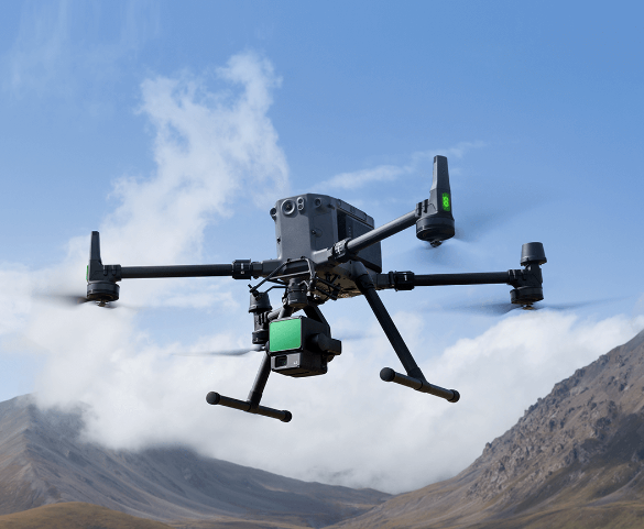
The new Zenmuse L2 further adopts an integrated design, integrating LiDAR, high-precision inertial navigation and 4/3 CMOS visible light mapping camera, and is equipped with a three-axis head, equipped with DJI M300 RTK and M350 RTK industry drones, you can open accurate, efficient and reliable three-dimensional data aerial acquisition tasks.

Compared with the previous generation, the range of the new generation of liDAR is increased by 30%, and the typical operating height can reach 150 meters, further improving the safety and efficiency of the operation.
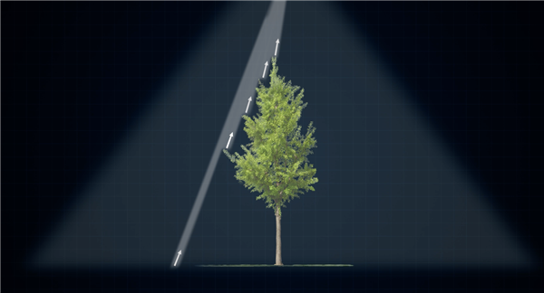
At the same time, the light spot is smaller and more concentrated, and can emit 240,000 laser dots per second, which can identify smaller objects and obtain finer models. It supports up to 5 echoes, which can penetrate more dense vegetation and collect more ground point cloud information.
The visible light mapping camera has 20 million effective pixels, richer point cloud coloring details, supports the use of mechanical shutters, and has a life of up to 200,000 times, further reducing operating costs. When there is no need to collect point clouds, the visible light camera can also capture images separately for visible light mapping.

It integrates GNSS and high-precision self-developed inertial navigation, and can achieve elevation accuracy of 4 cm and plane accuracy of 5 cm at a typical working height of 150 meters, which can meet the requirements of 1:500 high-precision terrain survey.
A single operation area of up to 2.5 square kilometers, with DJI Zhitu one-click processing, can easily reproduce the point cloud world.
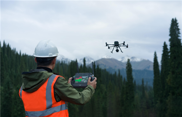
Zenmuse L2 allows 3D digital mapping quality and efficiency to achieve a new leap forward, and the working experience is further. In the operation process, DJI Pilot 2 APP supports visible light, point cloud, point cloud and visible light split screen three real-time display and preview, users can directly through the remote control to intuitively obtain the operation effect.
After the laser ranging function is turned on, the distance information between the radar module and the center object of the picture can be obtained, making the flight safer. It also supports four point cloud real-time coloring modes: reflectivity, height, distance and true color. Not only that, the operator can also quickly preview the currently recorded point cloud 3D model and sense the work process in real time.
Zenmuse L2 comes in two versions:
The basic set of 95,999 yuan can enjoy 2 replacement services within the first year of the device activation, and only need to pay the corresponding service fees to replace the damaged products with sound products. One year of cloud PPK service for an additional $1,499.
The flagship set of 103,999 yuan, in the first year of device activation, enjoy the value of the main body of the device guarantee, within the limit can enjoy unlimited free maintenance services. One year of cloud PPK service for an additional $1,499.
Zhang Xiaonan, senior strategic director of DJI Innovation, said: “UAV mounted Lidar is a hot spot in the development of the industry in recent years, to be sure, the rapid development of sensors required for automatic driving has catalyzed the process of civilian UAV Lidar.” Three years ago, the emergence of DJI Zenmuse Si L1, for geographic information, electricity, forestry and other industries to provide reliable, cost-effective three-dimensional digital solutions, and now the new Zenmuse Si L2 more marks the arrival of a new generation of civilian aerial survey tools.


